Log in
All resources
Create a design
35,690 Free Images of Round Maps
atlas of the russian empire (1800)
atlas of the russian empire (1792)
18th-century round portraits of women
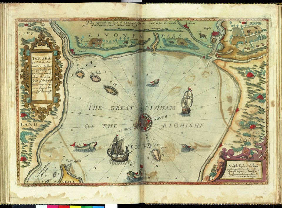
lucas janszoon waghenaer
charts and maps of the royal museums greenwich
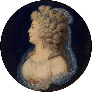
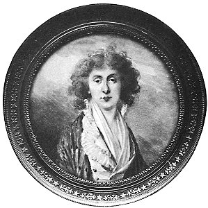
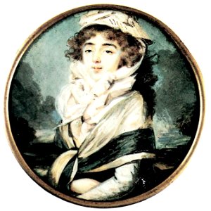
18th-century oval portrait miniatures of women at bust length
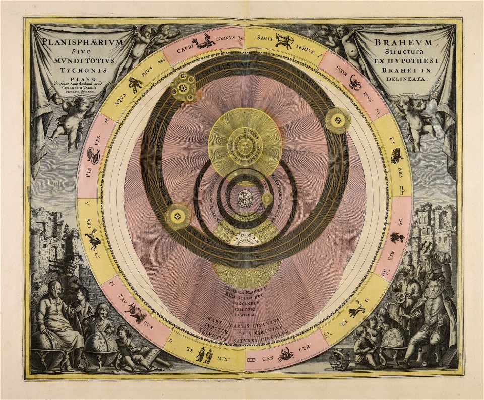
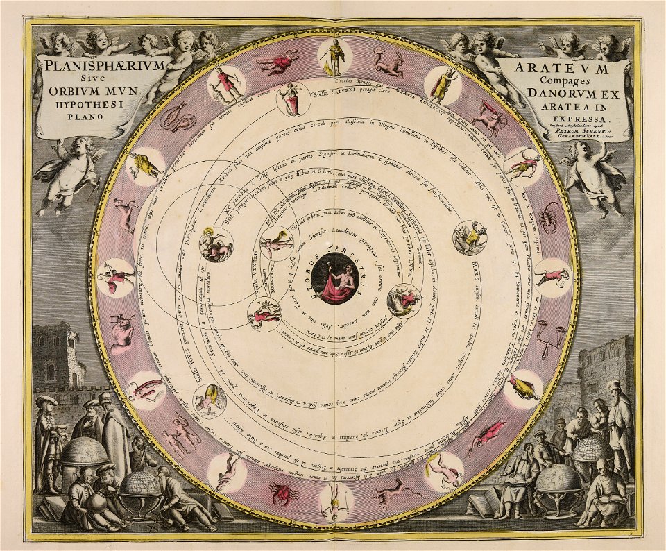
gerard valck
maps made in the 18th century
atlantis magni tomus primus (biblioteca comunale di trento)
pieter schenk (i)
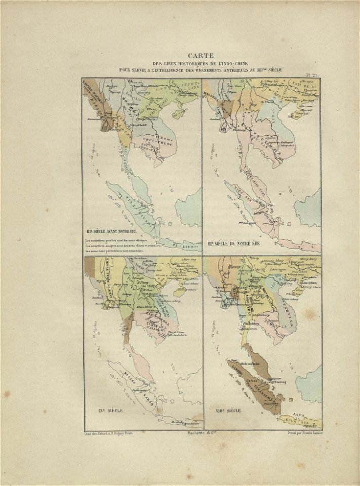
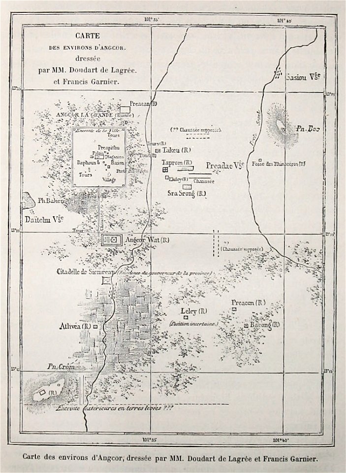
maps of indochina
francis garnier
voyage d'exploration en indo-chine - (1885
francis garnier
maps by gerardus mercator
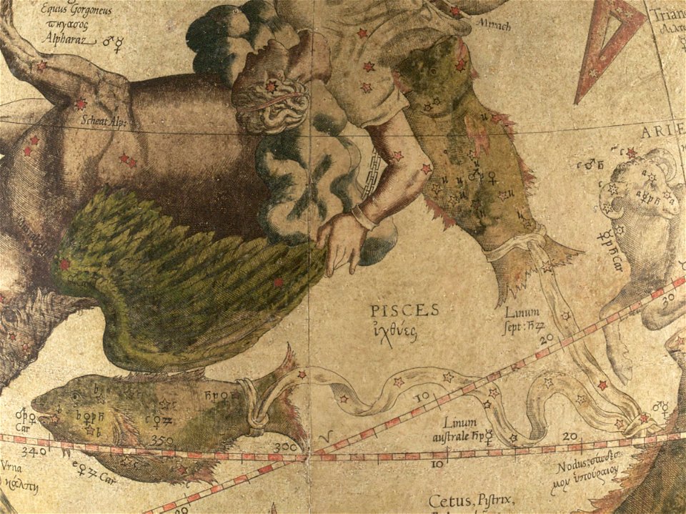
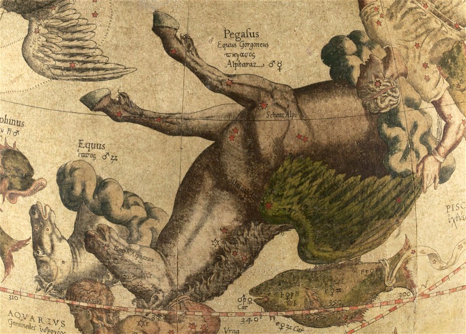
ursa major in art
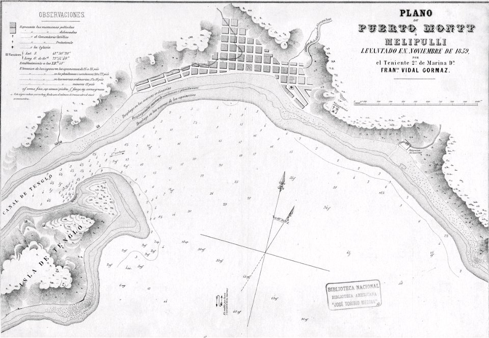
history of puerto montt
1859
description des principales villes (1690)
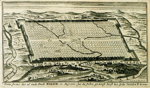
art of assyria
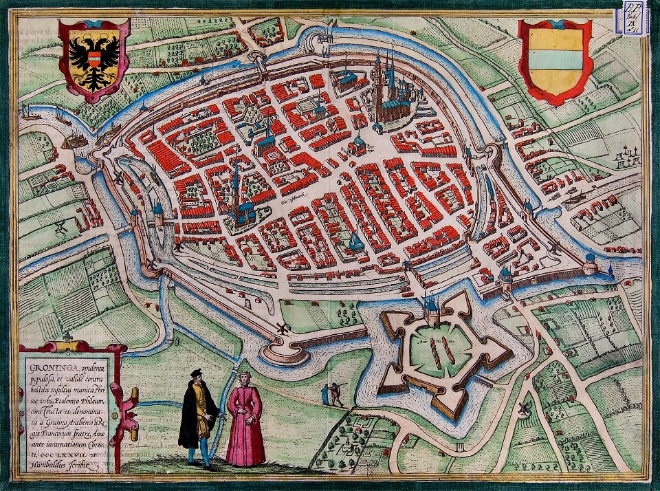
maps of groningen (city) by braun & hogenberg
great frisian war
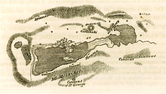
travels in sicily greece and albania
lake pamvotis
auberge de provence (valletta)
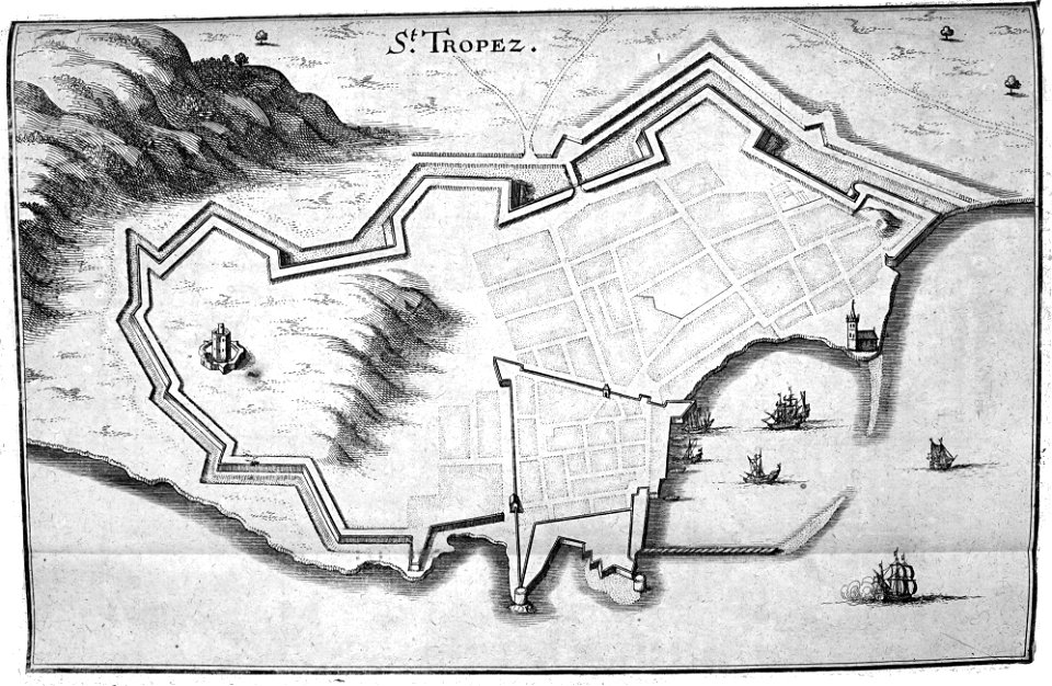
old maps of valletta
popular science monthly illustrations/volume 32
1880s maps of the bahamas
maps by gerardus mercator
mercator celestial globe
voyage pittoresque de la grèce
maps of the sea of marmara
engravings of topographia bohemiae moraviae et silesiae
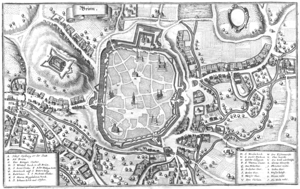
old maps of brno
bibliothèque municipale de reims
rès. g 153
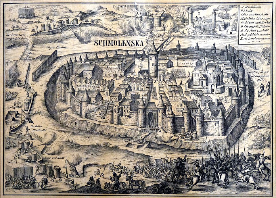
old maps of smolensk
willem hondius
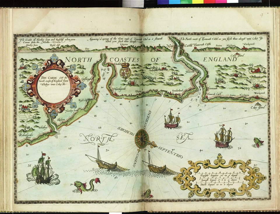
charts and maps of the royal museums greenwich
lucas janszoon waghenaer
charts and maps of the royal museums greenwich
lucas janszoon waghenaer
charts and maps of the royal museums greenwich
lucas janszoon waghenaer
atlas of the russian empire (1800)
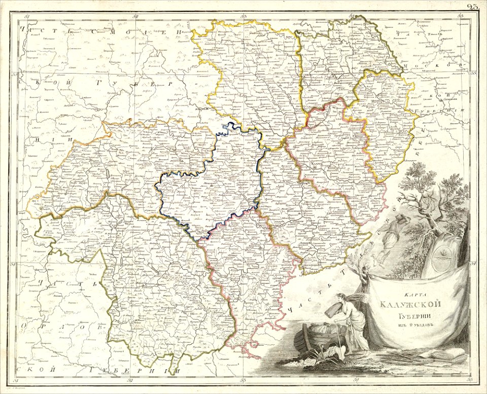
old maps of kaluga governorate
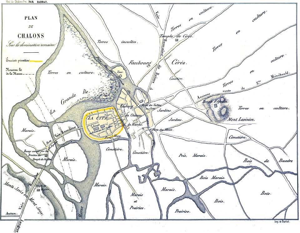
bibliothèque municipale de reims
maps of châlons-en-champagne
maps of yamaguchi prefecture
nagato province
charts and maps of the royal museums greenwich
lucas janszoon waghenaer
charts and maps of the royal museums greenwich
lucas janszoon waghenaer
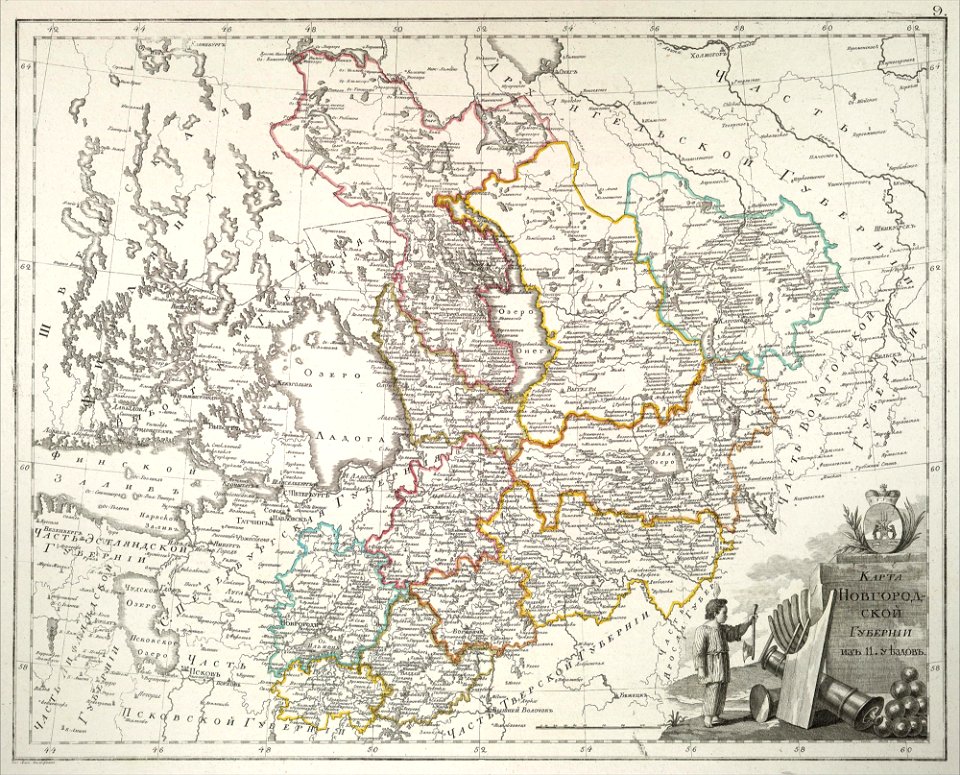
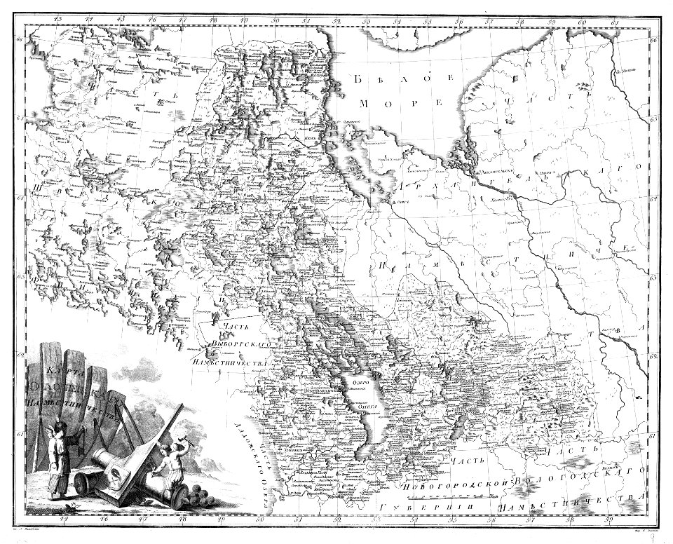
atlas of the russian empire (1800)
old maps of novgorod governorate
atlas of the russian empire (1800)
old maps of kursk governorate
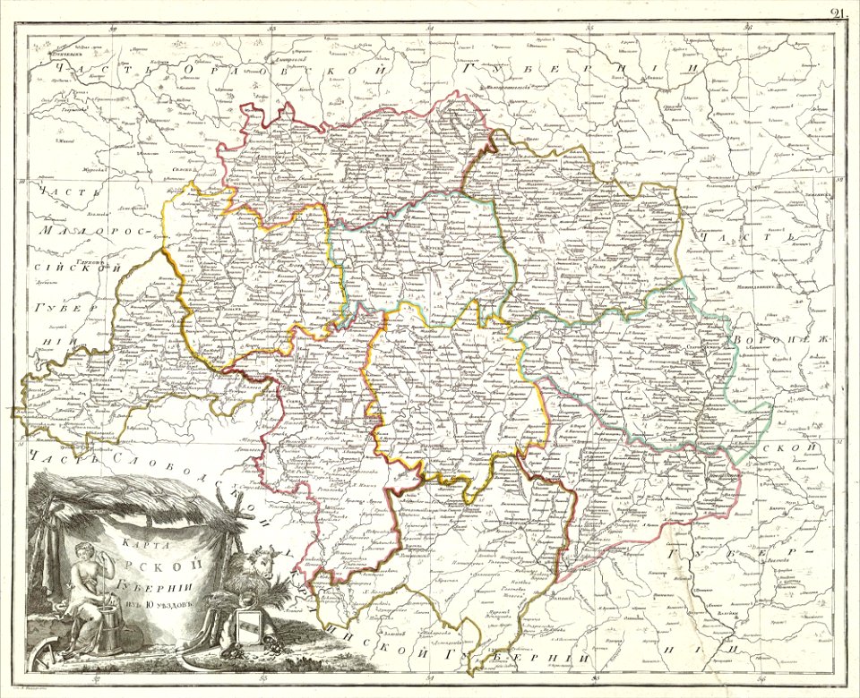
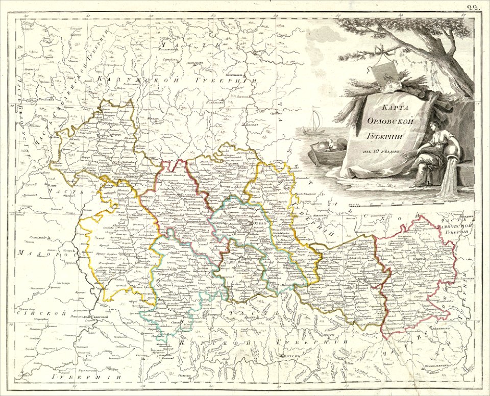
atlas of the russian empire (1800)
old maps of oryol governorate
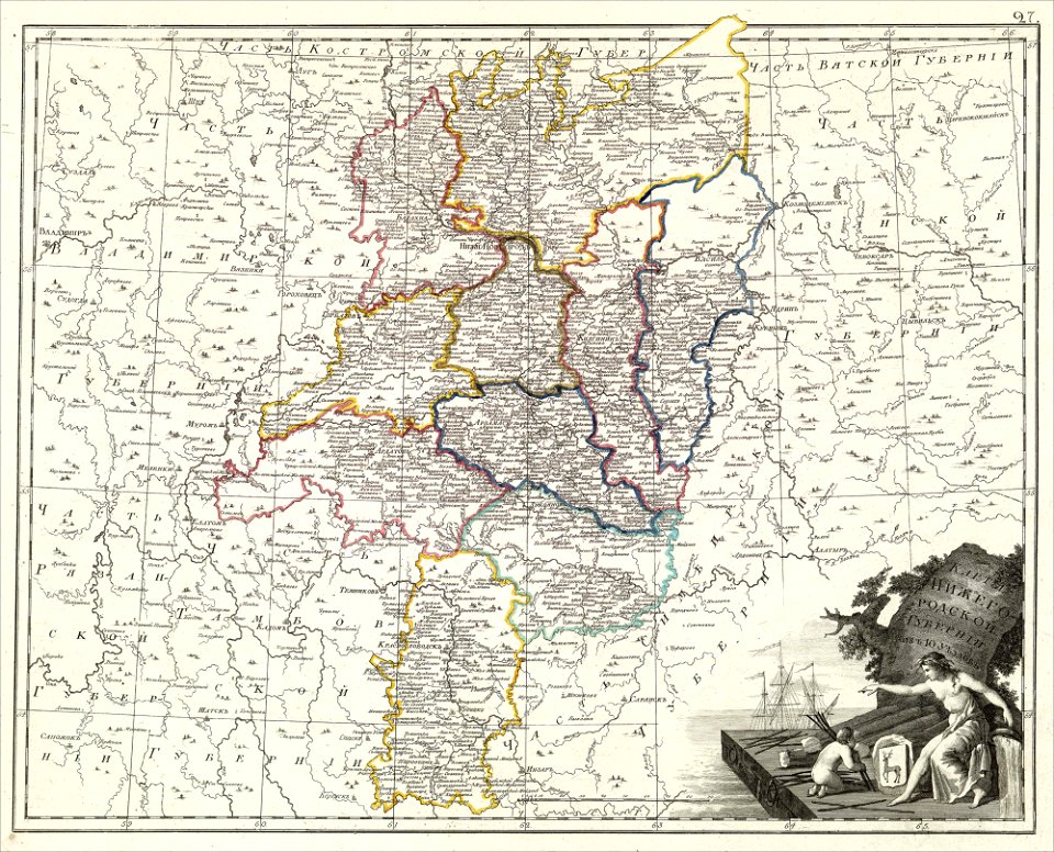
maps of nizhny novgorod governorate
atlas of the russian empire (1800)
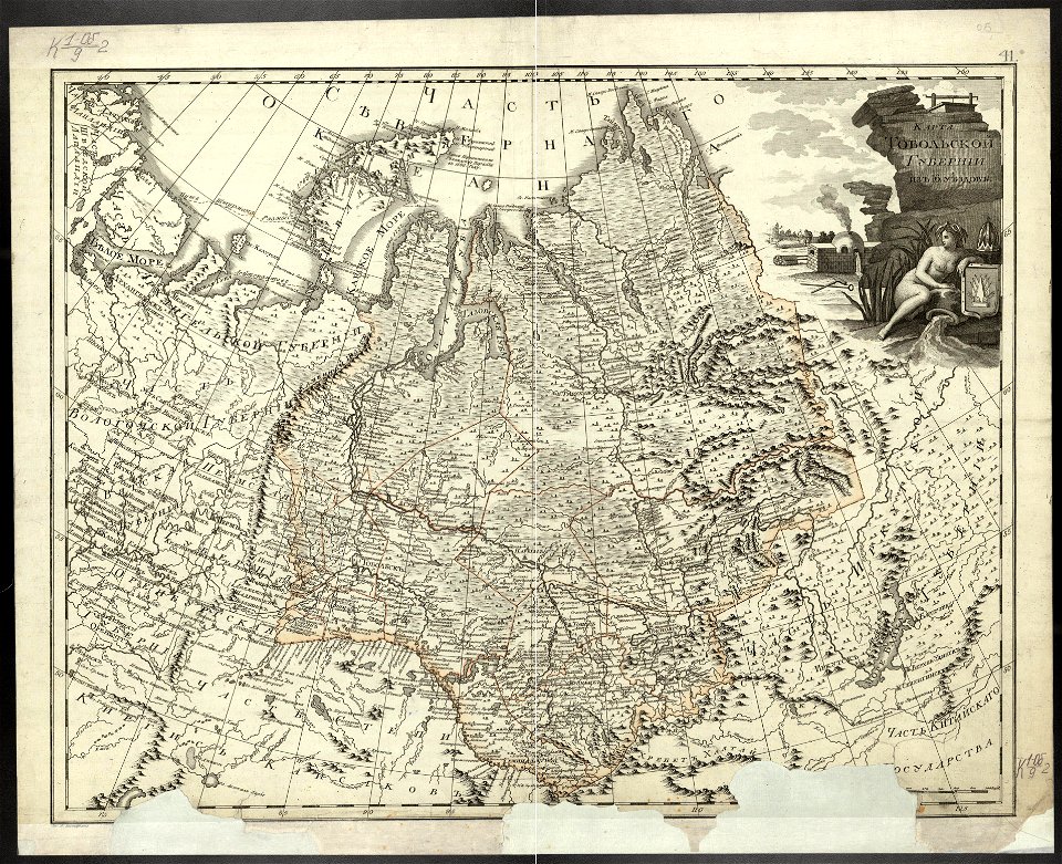
atlas of the russian empire (1800)
old maps of tobolsk governorate
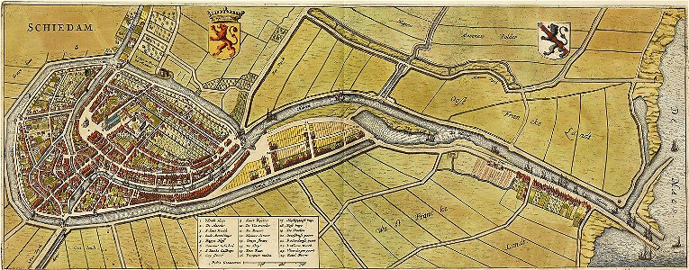
old maps of schiedam
atlas de wit 1698
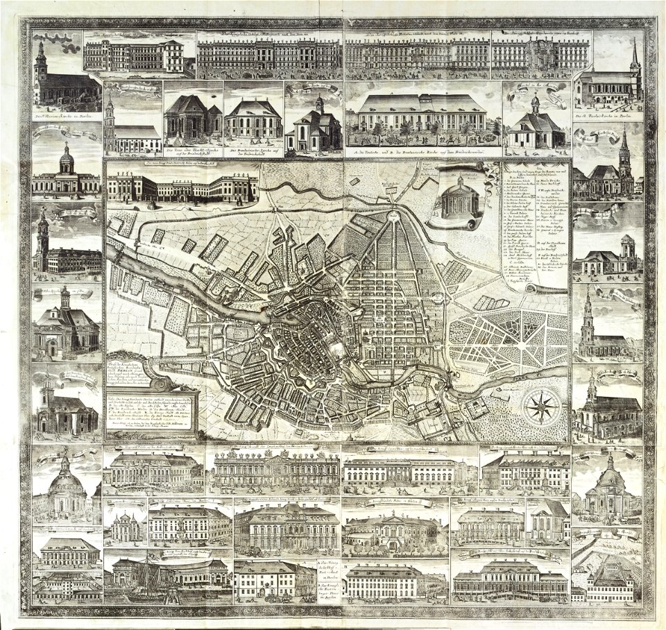
18th-century maps of berlin
johann david schleuen
atlas of the russian empire (1792)
old maps of saratov governorate
atlas of the russian empire (1800)
old maps of vyatka governorate
atlas of the russian empire (1792)
old maps of oryol governorate
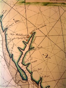
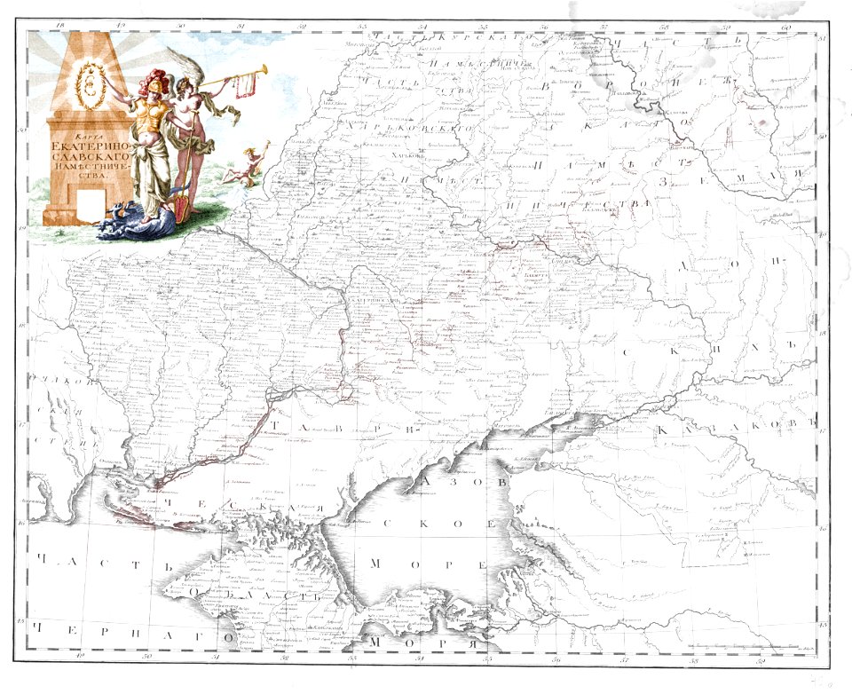
old maps of yekaterinoslav governorate
atlas of the russian empire (1792)
maps by gerardus mercator
pegasus (constellation)
atlas of the russian empire (1792)
old maps of olonets governorate
atlas of the russian empire (1792)
old maps of oryol governorate
engravings of topographia bohemiae moraviae et silesiae
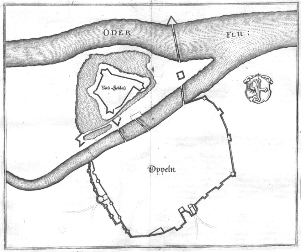
old maps of opole
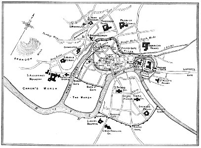
images from bristol past and present (1882)
old maps of bristol
cosmographia (1600) by sebastian münster
maps of the history of france
images from bristol past and present (1882)
old maps of bristol
walter kaudern expedition to celebes
walter kaudern
walter kaudern expedition to celebes
walter kaudern
beschreibung der reise von konstanz nach jerusalem
old maps of corfu
beschreibung der reise von konstanz nach jerusalem
old maps of corfu
description des principales villes (1690)
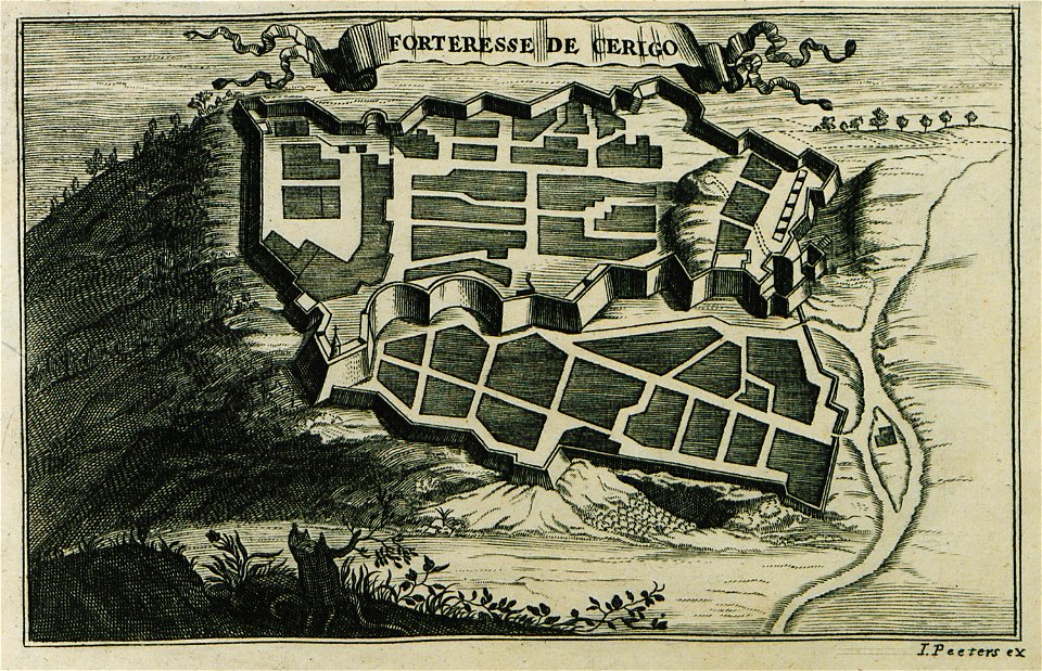
engravings of kythira
geographical illustrations by coronelli
history of the dodecanese
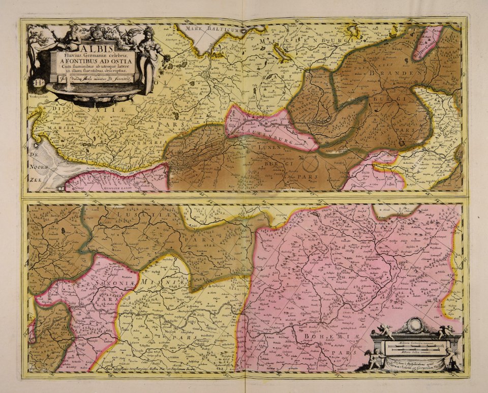
old maps of mecklenburg
atlas maior
parts of old maps of berlin
alte nationalgalerie
maps and topographical views by joris hoefnagel
historical images of brno
volume 7 of le tour du monde
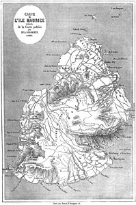
old maps of mauritius
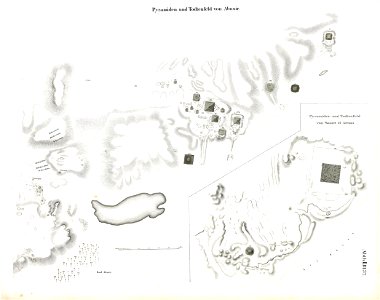
abusir pyramids
abusir
small atlas of the russian empire (1792)
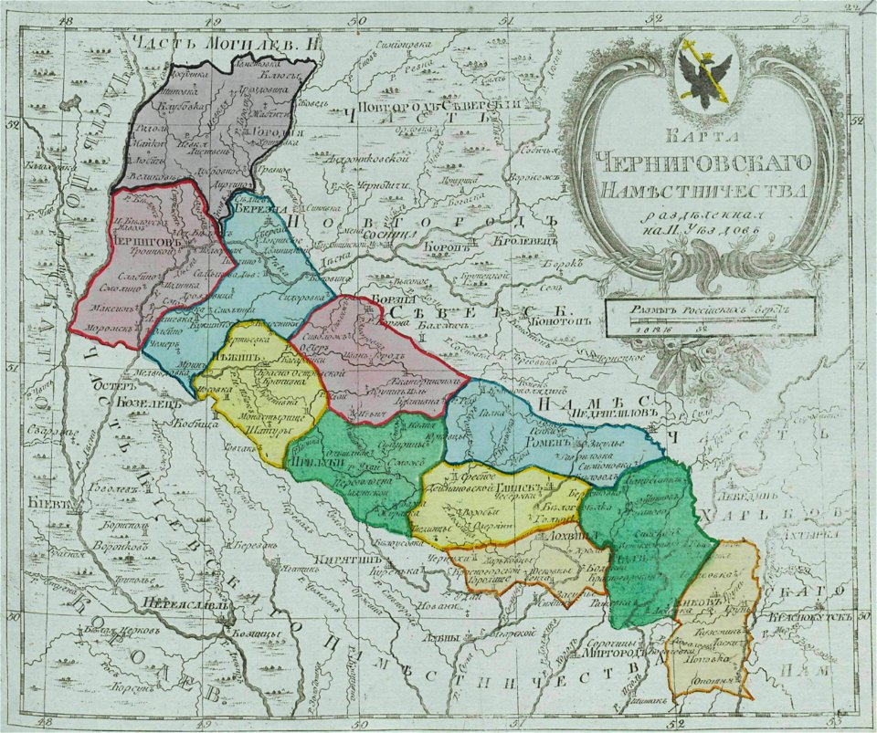
maps of chernigov governorate
university of toronto wenceslas hollar digital collection
maps by wenzel hollar
atlas of the russian empire (1792)
old maps of yaroslavl governorate
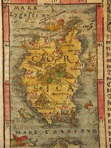
corsica (galleria delle carte geografiche)
old maps of corsica
engravings by matthäus merian
1640s maps of augsburg
provided by landsbókasafn íslands
philips galle
old maps of pomeroon
johannes van keulen
ducatus sleswicum sive justia australis
germany
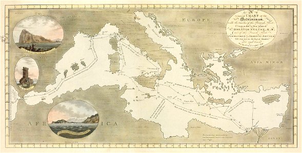
old maps of the indian ocean
robert surcouf
old maps of the indian ocean
robert surcouf
old maps of yekaterinoslav governorate
atlas of the russian empire (1792)
francesco piranesi
old maps of lazio
volume 9 of le tour du monde
1860s maps of africa
james william edmund doyle
owen bailey
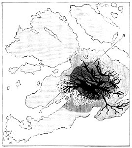
volcanic rock
isle of mull
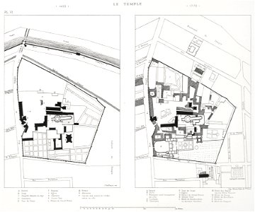
lithographs of paris
floor plans of paris
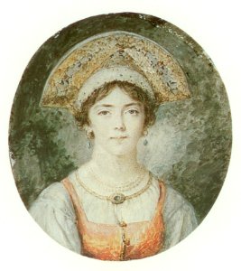
18th-century oval portrait miniatures of women at bust length
facing right and looking at viewer
frame painting
female
18th-century oval portrait miniatures of women at bust length
front view portrait paintings of females
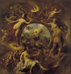
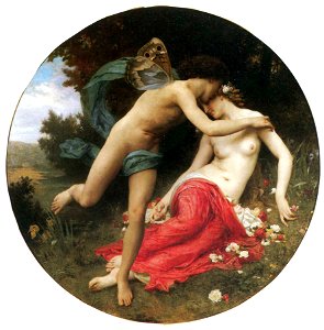
17th-century allegorical paintings
people with fire in art
18th-century oval portrait miniatures of women at bust length
facing right and looking at viewer
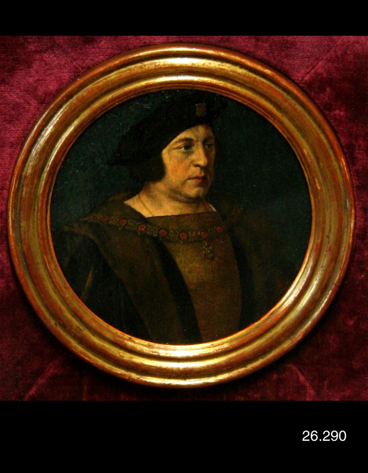
16th-century portrait paintings in the united states
16th-century round portraits of men
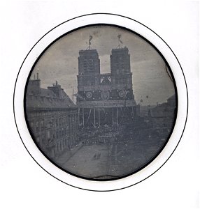
historical photographs of notre-dame de paris
photographs in the musée d'orsay
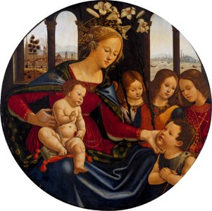
paintings of madonna and child in italy
round paintings of madonna and child
18th-century oval portrait miniatures of women at bust length
facing left
images from the new york public library
fichu
19th-century portrait miniatures of russia
portrait paintings in the pushkin museum
paintings of people in nature
paintings of butterflies
william shakespeare
charles
prints in the royal collection of the united kingdom
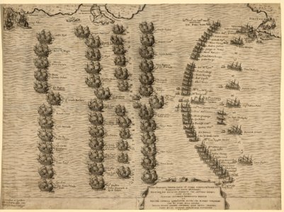
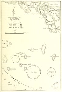
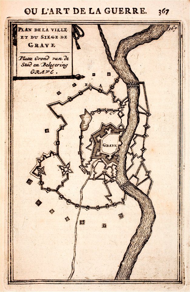
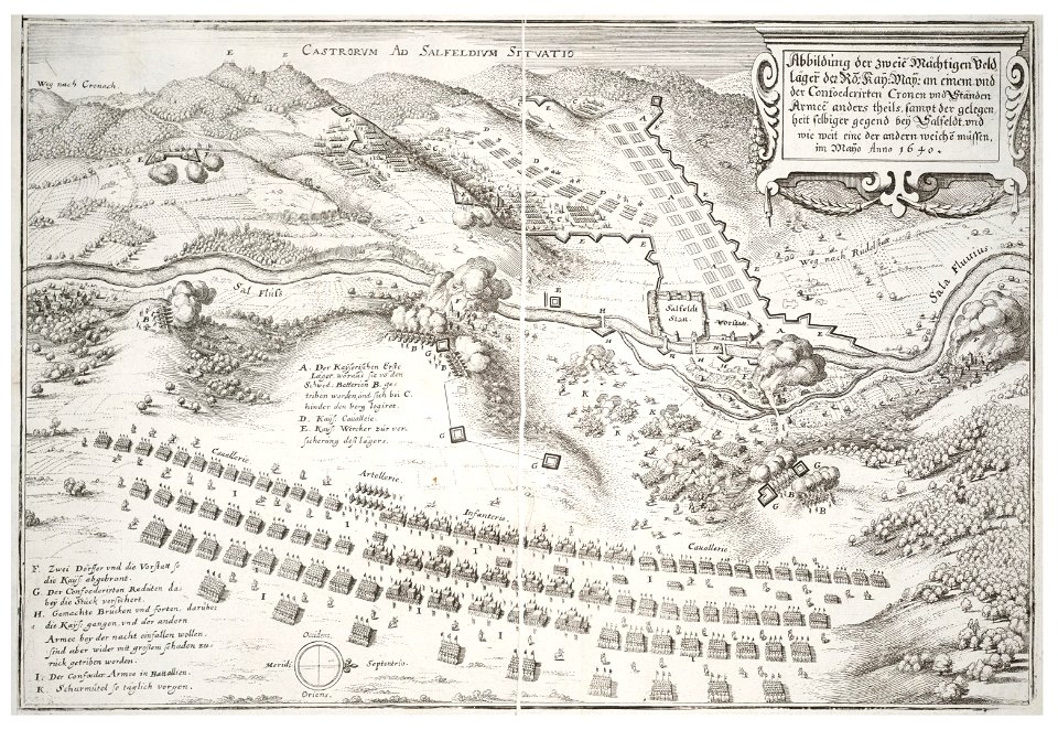
maps of battles of the thirty years' war
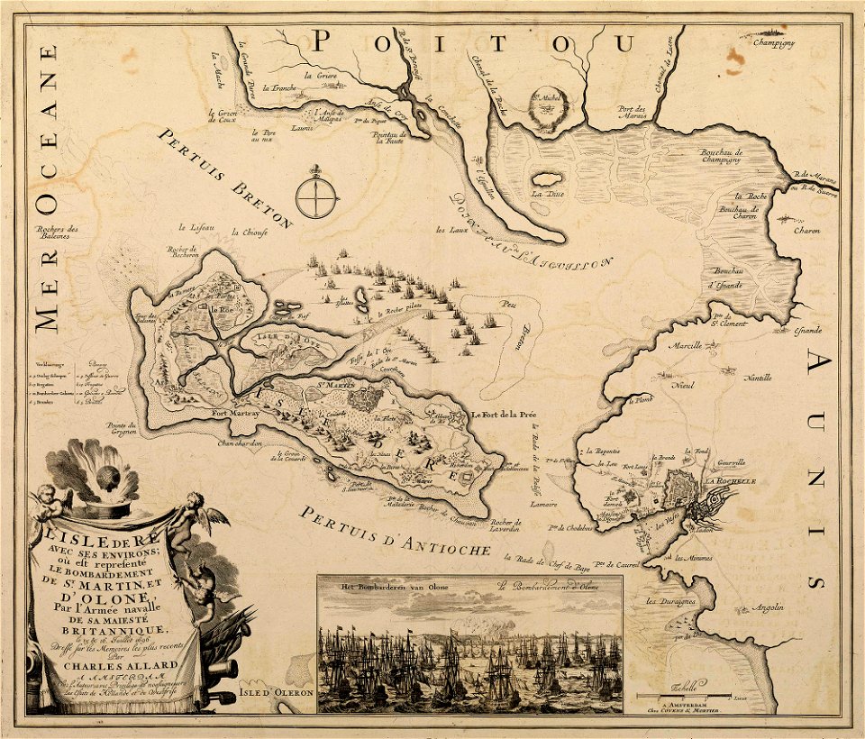
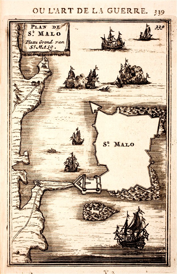
sainte-marie-de-ré
bombardment
netherlands
the hague
printing
london
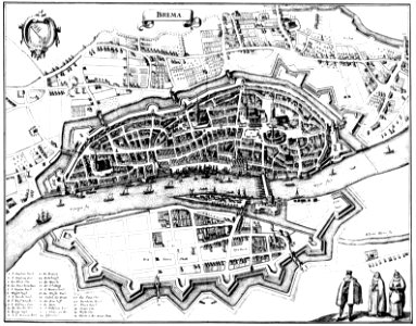
bremen in topographia saxoniae inferioris (merian)
engravings by matthäus merian
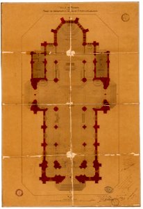
plans of churches in france
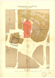
1875 maps
plans of churches in france
1873 in bretagne
scotland in the early modern period
maps of battles
british battles on land and sea
1873 drawings
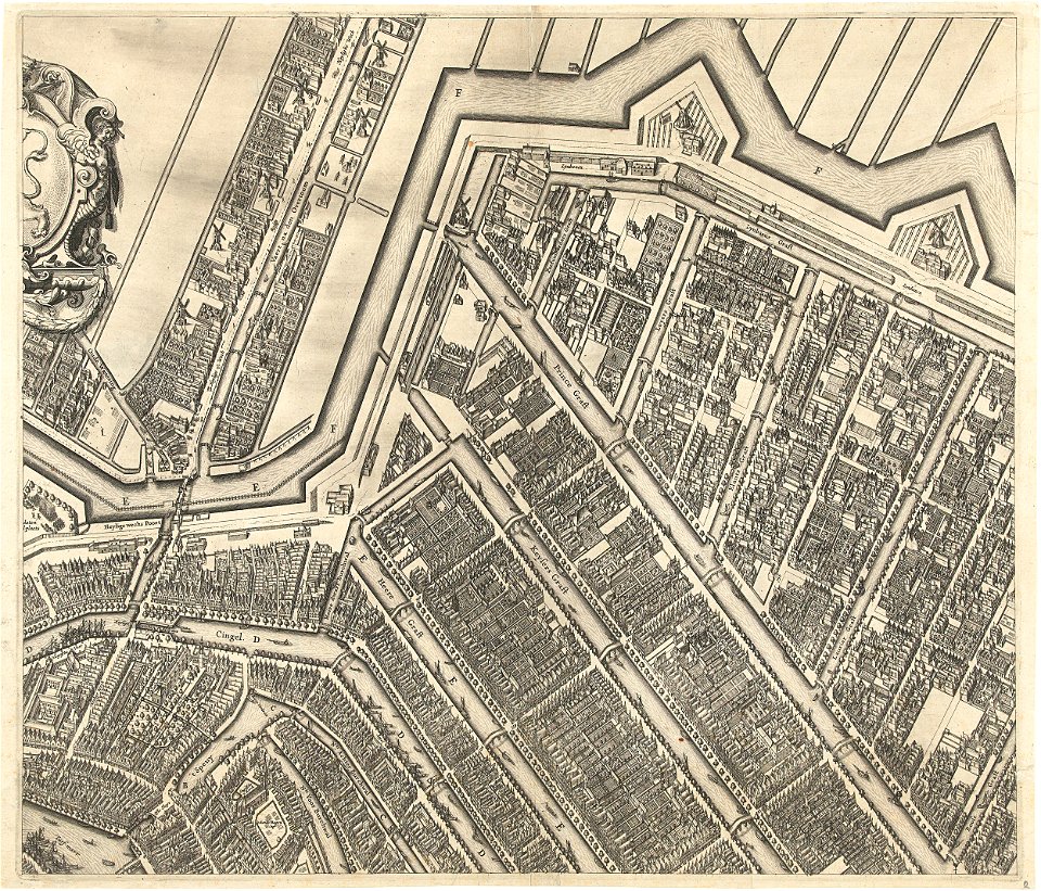
prinsengracht
amsterdam
maps made in the 17th century
gerard valck
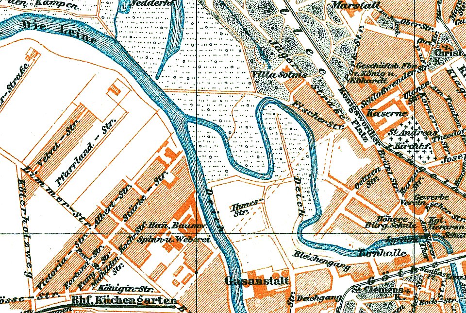
1888 in hannover
ihme
17th-century maps of maastricht
maps of the franco-dutch war
1696 in bretagne
1696 maps
conflicts in 1672
netherlands
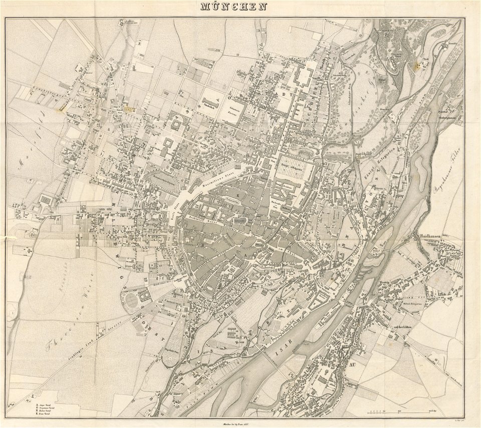
munich in the 19th century
old city maps of munich
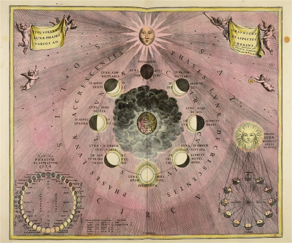
gerard valck
moon
maps made in the 18th century
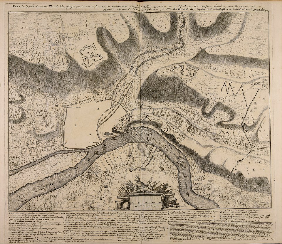
1705
maps made in the 18th century
gerard valck
maps made in the 18th century
gerard valck
8401 - 8500 of 35,690
Next page
/ 357


![A literary party at Sir Joshua Reynolds', James William Edmund Doyle, 1851[1]](https://cdn.creazilla.com/illustrations/10001566600/a-literary-party-at-sir-joshua-reynolds-james-william-edmund-doyle-18511.jpg)